
")
The carbon deposits
The SeaForest LIFE project foresees the quantification of carbon deposits and their rate of change related to habitat degradation due to pleasure boat’s anchors and moorings. To this aim, an updating of habitat 1120*’s cartography in each of the Marine Protected Areas engaged in the project have been fulfilled, using high-definition multispectral imagery. Furthermore, monitoring of the areas with the highest attend-ance of the anchorages was carried out through the use of medium resolution satellite multi-spectral images using the infrared band, to identify and quantify the degradation and the state of conservation of the Posidonia oceanica meadows present in the areas of interest of the project.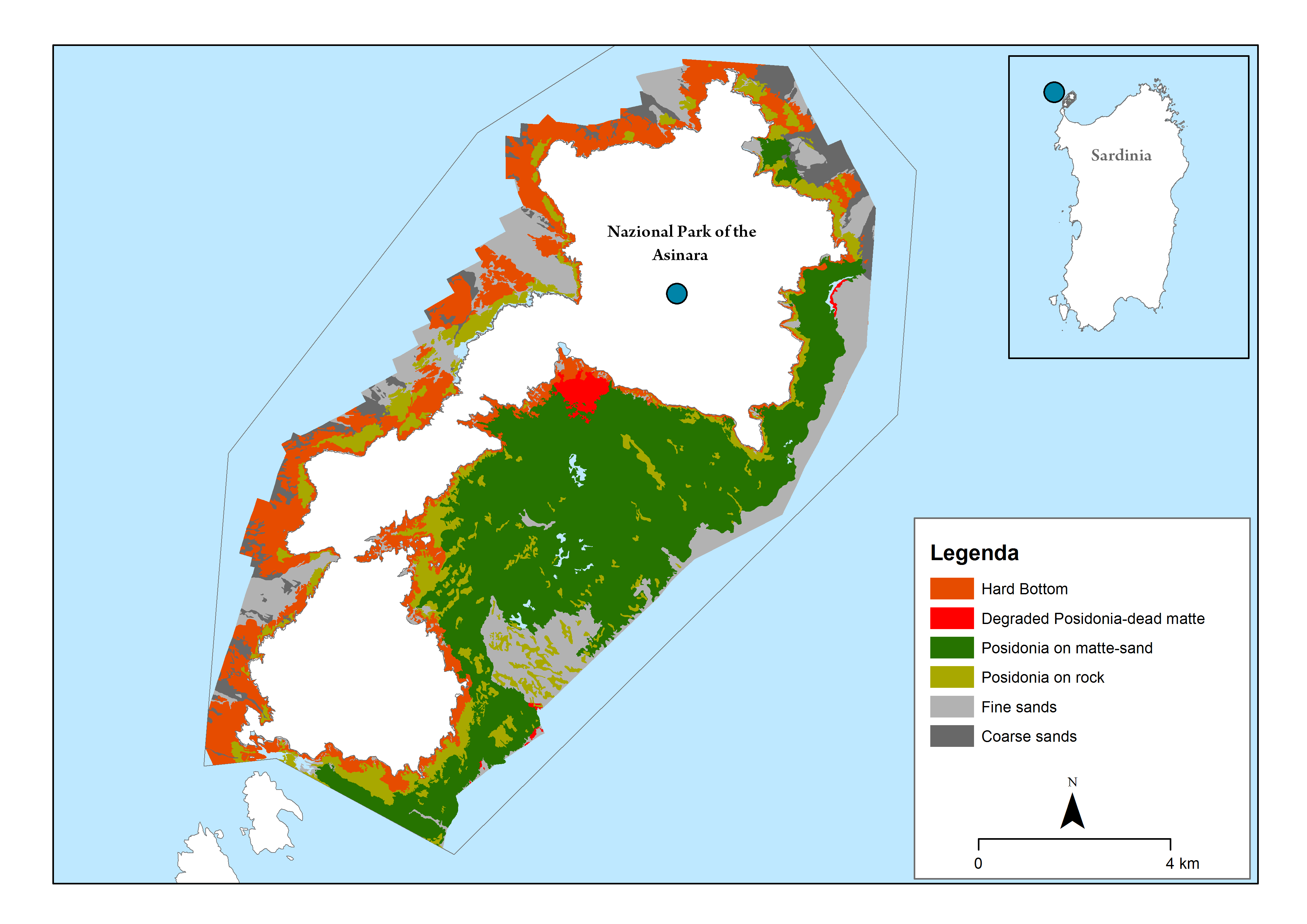
Preliminary map of the extension of the Posidonia oceanica meadows in the Asinara National Park.
From the first results, it appeared evident a high impact by the boats in particularly sensitive areas. In the Isola Piana area, in the Asinara National Park, for example, 367 boats have been registered, analyzing 4-time scenes (16 and 26 of July, 10 and 15 of August 2019) of which 70 anchorages on Posidonia oceanica. Only 28 boats had a low impact, while 202 boats had a medium impact and 167 a high impact.For the Archipelago of La Maddalena National Park, 284 boats were registered on days of maximum inflow for the area of Porto della Madonna and 242 boats in the Cilento National Park areas. These data refer to a single day and the tourist period (and high attendance of boats) in the National Parks of the project varies from 2 to 3 months each year. Their impact can, therefore, be very high if docking is not properly managed.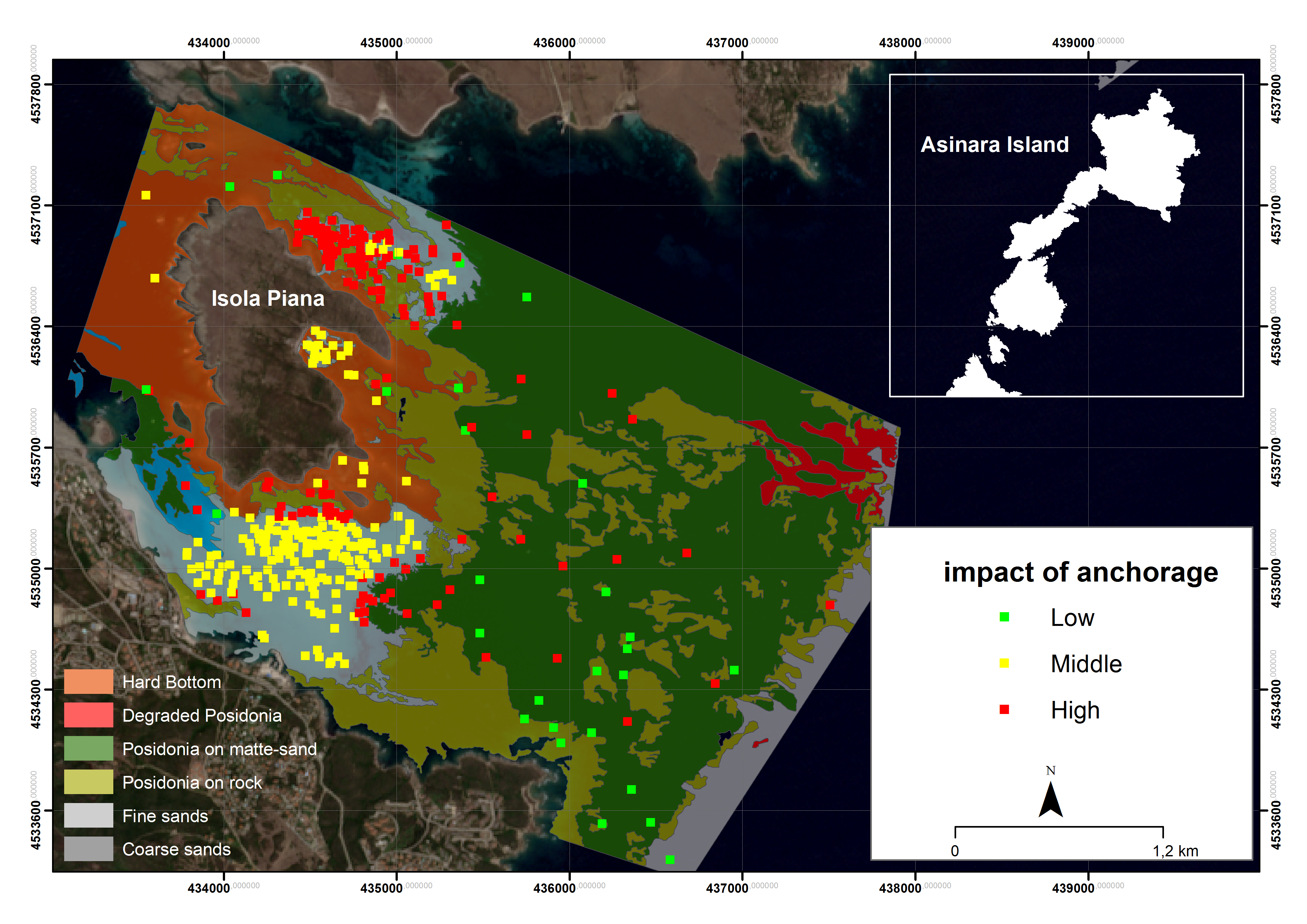
Identification of the impact zones of the anchorages and assessment of the degradation of the Posidonia oceanica meadows around the Piana Island in the Asinara National Park.
The updated cartography of the Posidonia oceanica meadows has been used to implement the InVEST Coastal Blue Carbon which attempts to predict the sequestration, storage and, when degraded, the emissions of carbon by coastal ecosystems. Also, using an estimate of the monetary, social value the model quantifies the marginal value of this service. In this context, InVEST results can help to identify locations within the landscape where degradation should be avoided, and restoration should be prioritized.
Preliminary results on a large scale in the 3 study areas showed that the carbon accumulation rate in the living portions of the seagrass meadow varies from 7.13 to 217 g Corg/m2/ year. Therefore, about 1400 ha of degraded grasslands and about 460 ha of grasslands in good state of health (eg Posidonia oceanica on matte and sand and Posidonia oceanica on rock) are needed to produce a ton of Corg (carbon credit) in a year.
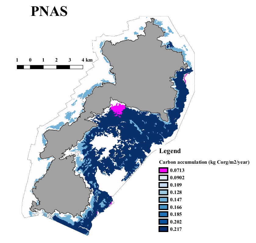
Preliminary map of the estimate of carbon stocks in the Asinara National Park.